
Transforming Flood Insurance: The Role of National Flood Data in Smarter Underwriting and Better Risk Assessment
Explore how insurers can leverage FEMA data to underwrite smarter flood insurance policies, adapting to evolving flood risks and enhancing coverage through NFIP.
In an era where climate change is increasingly influencing weather patterns, the insurance industry faces the daunting challenge of effectively managing flood-related risks. As floods become more frequent and severe, the financial burden on insurers grows, necessitating smarter underwriting and better risk assessment strategies.
National Flood Data, with its comprehensive FEMA flood maps and cutting-edge risk information, is revolutionizing the way insurance companies approach flood insurance, enabling them to accurately quantify insurance risk and minimize potential losses. By leveraging this data, insurers can not only set precise premiums but also encourage homeowners to take preventive measures, thereby reducing the severity of claims.
This document will delve into how National Flood Data empowers insurance professionals, policy makers, and concerned homeowners to stay ahead of the curve, fostering enhanced customer retention and policy adjustments in the face of climate change impact.
Quantifying the Impact on Insurers
Financial Burden of Flood Damage
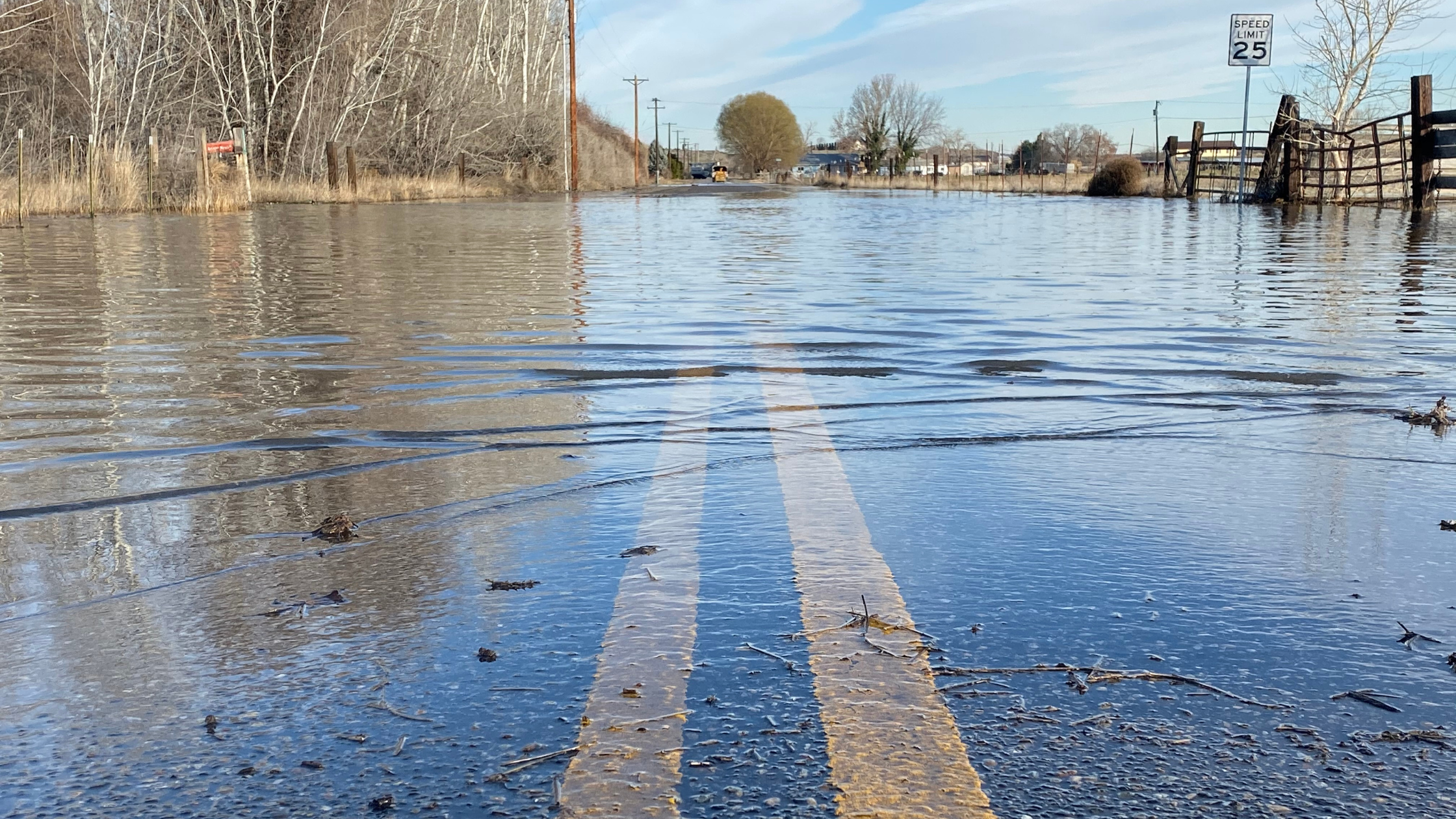
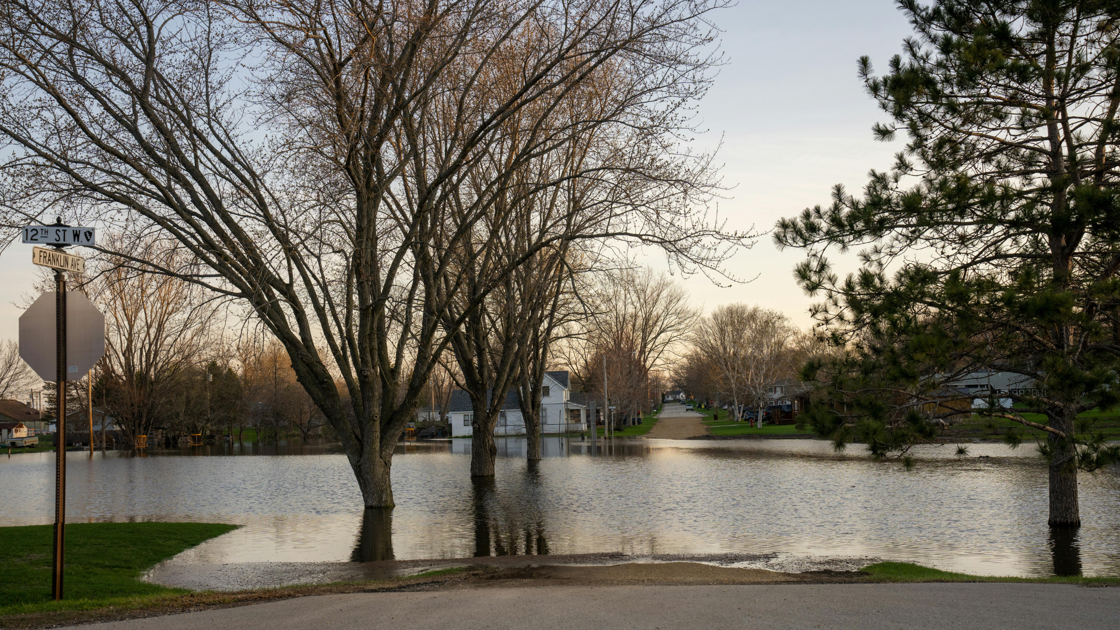
The rising frequency and severity of floods due to climate change have significantly increased the financial strain on insurance companies. In recent years, flood-related claims have surged, with payouts reaching billions of dollars annually. According to the National Flood Insurance Program, the average flood claim in 2020 was $52,000, a substantial increase from previous years. This trend is forcing insurers to reassess their risk models and pricing strategies.
The compounding effect of multiple severe flood events in a single year can strain even the most robust insurance portfolios. As a result, many insurers are seeking innovative ways to mitigate their exposure to flood risks while maintaining their ability to provide essential coverage to policyholders.
Rising Costs Due to Climate Change
Climate change is amplifying the frequency and intensity of flood events, leading to a sharp increase in insurance costs. As global temperatures rise, extreme weather patterns become more common, resulting in heavier rainfall and storm surges. This shift has expanded flood-prone areas beyond traditional floodplains, catching many homeowners and insurers off guard.
The financial impact is staggering. According to recent studies, climate change could increase flood damages by up to 26% by 2050. Insurers are grappling with the challenge of accurately pricing policies in this rapidly evolving risk landscape. The unpredictability of climate-induced flooding makes it difficult to rely solely on historical data for risk assessment.
To address this, insurers are increasingly turning to advanced modeling techniques and real-time data to better understand and quantify the climate change impact on flood risks.
Proactive Risk Assessment Strategies
Utilizing FEMA Flood Data
National Flood Data provides FEMA flood maps to insurance companies, serving as a cornerstone for proactive risk assessment strategies. These comprehensive maps and datasets, along with additional data tailored to customer needs, offer crucial information on flood zones, base flood elevations, and historical flood events. By integrating this expansive data into their underwriting processes, insurance companies can more accurately assess flood risk for individual properties and entire regions.
Many insurers prefer to use more than just information about whether a property is in a special flood hazard area. Some consider the property's distance to nearby special flood hazard areas, the elevation of the property, and the local base flood elevation, while others check community participation information or require a map to show their clients.
Every service that National Flood Data offers was built based on specific customer needs. We collaborate closely with our customers—primarily insurance companies—to deliver precisely what they require for their unique evaluation processes.
The granularity of FEMA flood data, combined with the customizable services of National Flood Data, enables insurers to differentiate between high-risk and low-risk areas within the same zip code, allowing for more precise premium setting and helping insurers avoid overexposure in flood-prone areas. Moreover, FEMA regularly updates its flood maps to reflect changes in flood risks due to factors such as urbanization and climate change, ensuring that these assessments stay current and relevant.
Setting Accurate Premiums and Preventing Losses
Accurate premium setting is crucial for maintaining a sustainable flood insurance market. By leveraging comprehensive flood data, insurers can develop sophisticated risk models that account for various factors influencing flood risk. These models consider not only the likelihood of flooding but also the potential severity of damage, allowing for more nuanced pricing strategies.
This data-driven approach enables insurers to offer fair premiums that reflect the true risk of each property. For high-risk areas, higher premiums can be justified, while properties in lower-risk zones benefit from more affordable rates. This granular pricing encourages property owners to invest in flood mitigation measures, as they can see direct financial benefits through reduced premiums.
Moreover, insurers can use this data to guide policyholders in implementing preventive measures. By providing specific recommendations based on a property's risk profile, insurance companies can help reduce the severity of potential claims. This proactive stance not only protects the insurer's financial interests but also fosters a collaborative relationship with policyholders in managing flood risks.
Educating Policyholders for Fewer Claims
Encouraging Preventive Measures
Insurers can leverage flood data to educate policyholders about specific risks to their properties and encourage the implementation of preventive measures. By providing detailed information on potential flood scenarios, insurance companies empower homeowners to take proactive steps in protecting their assets.
These preventive measures can include installing flood barriers, elevating critical systems, or improving drainage around the property. Insurers can offer incentives such as premium discounts for policyholders who implement these flood-proofing techniques. This approach not only reduces the severity of potential claims but also fosters a sense of shared responsibility in mitigating flood risks.
Additionally, insurers can use flood data to recommend early policy adjustments based on changing risk profiles. By staying ahead of evolving flood patterns, policyholders can ensure they have adequate coverage before a flood event occurs. This proactive stance helps minimize gaps in coverage and reduces the financial impact of flood damage for both the insurer and the policyholder.
Importance of Early Policy Adjustments
Early policy adjustments play a crucial role in maintaining adequate flood insurance coverage as risk landscapes evolve. By utilizing up-to-date flood data, insurers can identify changes in flood risk for specific areas or properties and proactively recommend policy updates to their clients.
These timely adjustments ensure that policyholders are neither underinsured nor overinsured as their risk profiles change. For instance, if flood maps indicate an increased risk for a particular region due to climate change impacts, insurers can advise homeowners to increase their coverage limits. Conversely, if flood mitigation efforts have reduced risk in an area, policyholders might benefit from adjusted premiums.
Encouraging early policy adjustments also helps insurers manage their overall risk exposure more effectively. By aligning coverage with current risk assessments, insurance companies can maintain a balanced portfolio and ensure their ability to meet potential claims. This proactive approach to policy management fosters trust between insurers and policyholders, demonstrating a commitment to providing relevant and valuable protection against flood risks.
What is the significance of FEMA data in underwriting flood insurance policies?
The Federal Emergency Management Agency (FEMA) provides critical data that helps insurers understand flood riskin specific areas. By analyzing flood maps and other hazard assessments, insurers can make informed decisions about how to underwrite their flood insurance policies. This data is vital for determining premium rates and coverage limits, ensuring that both the insurer and policyholder are adequately protected against potential flood damage.
How does the National Flood Insurance Program (NFIP) influence flood insurance underwriting?
The National Flood Insurance Program (NFIP) offers a standardized framework for flood insurance, which many insurers utilize to assess flood risk and set premium rates. The program provides flood maps that categorize areas into flood zones, allowing insurers to evaluate the likelihood of flood events and adjust their insurance underwriting practices accordingly. By leveraging NFIP’s data, insurers can improve their risk assessment processes and design more effective flood insurance policies.
What is Risk Rating 2.0 and how does it impact flood insurance?
Risk Rating 2.0 is an initiative by the NFIP aimed at modernizing the way flood insurance policies are priced. It utilizes more granular data, including property-specific information, to provide a fairer assessment of flood risk. This approach helps insurers better understand the specific vulnerabilities of properties, leading to more accurate flood insurance rates and improved flood coverage options for policyholders.